LA TIERRA EN EL UNIVERSO
LA TIERRA NO ES PLANA
¿QUÉ TE HACE DECIR ESO?
Desmontando el terraplanismo
Animaciones interactivas del sistema solar
Planetas comparados
LAS CONDICIONES QUE HACEN POSIBLE LA VIDA EN LA TIERRA
LA FORMA DE LA TIERRA

LOS MOVIMIENTOS DE LA TIERRA
ROTACIÓN
TRASLACIÓN
¿Qué pasaría si la Tierra dejase de girar?
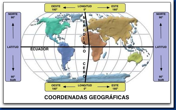
COORDENADAS GEOGRÁFICAS
LAS LÍNEAS TERRESTRES
Practica un poco
¿Qué es esto?
41,65 -3,68
PARALELOS Y MERIDIANOS
Cómo diferenciar paralelos y meridianos
LATITUD Y LONGITUD
ACTIVIDADES INTERACTIVAS
LA REPRESENTACIÓN DE LA TIERRA
LAS PRINCIPALES PROYECCIONES CARTOGRÁFICAS
¿Quieres conocer el verdadero tamaño de los países y compararlos? Pincha en la imagen, te va a sorprender.
Esta podría ser la proyección cartográfica más fiel hasta el momento. Ha sido creada por el japonés
Comparamos la proyección de Mercator con la proyección de Peters
LOS MAPAS
LOS HUSOS HORARIOS/ TIME ZONES
Bilingual: video explaining time zones
Compruébalo en estos mapas de husos horarios:
Practica hasta dominar los husos horarios con estas actividades:Actividad 7


0 Comentarios