1. LOOKING INSIDE THE EARTH
First, let’s clarify what we’re studying here: the geosphere. To sum up, the geosphere is the solid part of the Earth where living things live.
What’s the
point in knowing the inner structure of the Earth?
Well, only by knowing it, we can understand how the
relief is created. So, take a look at this video
This animations with will make it clearer for you.

A BRIEF HISTORY OF GEOLOGIC TIME
2. THE SURFACE OF THE EARTH IS MOVING! HOW THE RELIEF IS FORMED
TECTONIC PLATES AND CONTINENTAL DRIFT
Yes, that’s right. The lithosphere (crust and upper
mantle) is cracked.
There are several pieces called plates which slowly move due to inner forces of the Earth. The plates collide or separate creating new
relief forms and other phenomena. We call this plate
tectonics.
Here's how it works


LA DERIVA CONTINENTAL Y LAS CÉLULAS DE CONVECCIÓN DEL MANTO
Want more visual
help?
This animation shows the different plates in the world. You can set the options and watch the movements.
This animation shows the different plates in the world. You can set the options and watch the movements.
THE THREE BASIC MOVEMENTS OF THE PLATES. PLATES BOUNDARIES


You can learn the basics by watching this animation:
Let’s explain everything a bit more
a. COLLISION (convergent boundaries)

The first thing we need to have into account is that
some plates are thinner and some are thicker. Ocean plates are thinner than continental plates. Knowing this, the collision can occur
in different ways:
- Collision between an oceanic and a continental plate

The ocean plate, thinner, slides under the continental Pate. This process in called subduction. There are lots of earthquakes and volcanic eruptions.
The oceanic plate melts as it re-enters the
mantle. The magma rises and erupts. This creates a volcanic mountain range near the coast of the continent. This range
is called a continental or volcanic arc.
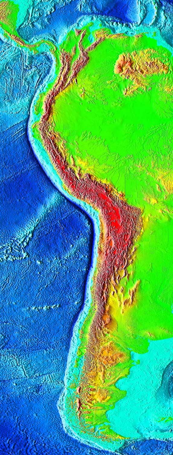
Did you know that The Andes Mountains are a volcanic arc created by the collision of the Nazca
plate and the South American Plate?


-
Collision between an oceanic and another oceanic plate

When two oceanic plates collide, one usually slides under the other, and
in the process a trench is formed. Also,
a lot of volcanoes are erupt.

Over millions of years, the erupted lava and volcanic debris pile up on
the ocean floor until a submarine volcano rises above sea level to form an island volcano or even a volcanic
arc.
As an example, the Marianas islands and Marianas Trench

Japan

FIND OUT!
FIND OUT!
Another wonderful example
are the Aleutian Islands next to Alaska. Can you find them using Google Earth? Explore the area and locate the trench.
- Collision between a continental and another continental plate.

When two continental plates collide, neither is subducted. Instead, the crust usually folds upwards creating mountain ranges.
The Himalayas is a good example of this case.

b. Separation (divergent boundaries)
We find divergent
boundaries where plates are moving apart and new crust is created by magma pushing up from the mantle.
Perhaps the best known of
the divergent boundaries is the
Mid-Atlantic Ridge. Seafloor spreading over the past 100 to 200 million
years has caused the Atlantic Ocean to grow from a tiny inlet of water between
the continents of Europe, Africa, and the Americas into the vast ocean that
exists today.
Iceland is in its way and it’s cracking in two.


FIND OUT!
Can you find the Md-Atlantic Ridge using Google Earth?
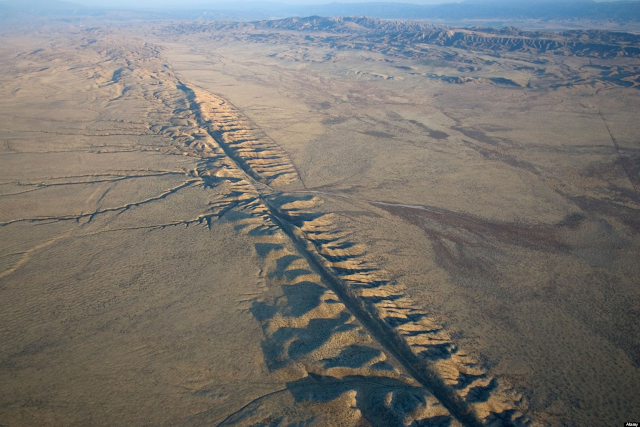
c. Transform boundaries
When two plates slide horizontally. Also called
transform faultS.

Most transform faults
are on the ocean floor. They move in a zig zag way and produce earthquakes.
There are a few on land. For
example, the San Andreas Fault zone in California.


HOT SPOTS
What are hot spots?
In geology, hot spots are volcanic regions where the mantle is particularly hot compared with the
surrounding mantle.

Plates on the move game

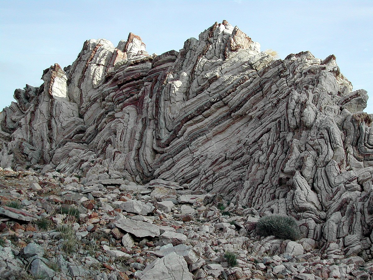
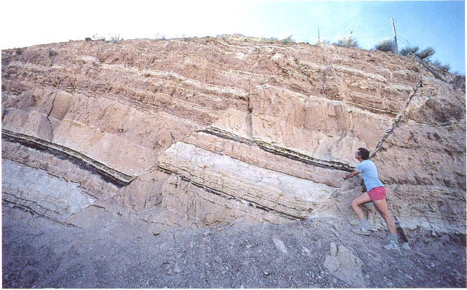
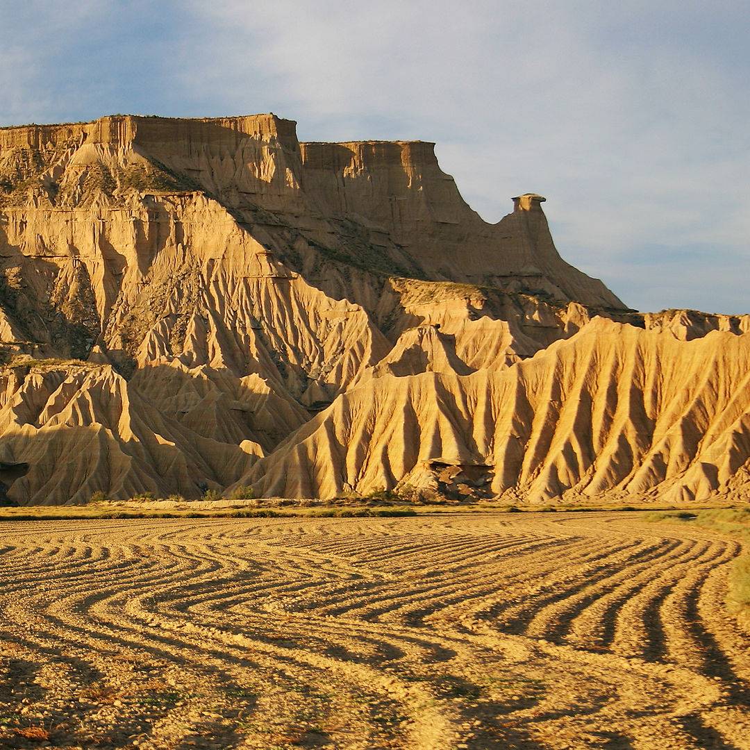
FOLDS AND FAULTS
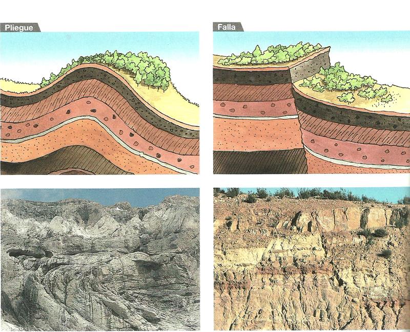
FOLDS
![cytisan [licensed for non-commercial use only] / Pliegues y fallas](https://lh4.googleusercontent.com/-Lr2Xn-_sVpdDwd1z3RtqYmWQqq7jbg9Pw6C9n5_KE24llYsy032fUWG8DaichztrT8DrgOOyPTAIJ3KShvNvPZjudbv2Fhkg-Ccd32nVhQnnLEhj5Ve2oq4-N6QRjIjr95nKRGF)
FAULTS


THE SHAPING OF RELIEF
Wall picture discussion:
¿how was it shaped?
AGENTES PROTAGONISTAS DEL MODELADO DEL RELIEVE

¿CÓMO SE PRODUCEN ESTOS CAMBIOS?

MAIN LANDSCAPE FORMS

COASTAL RELIEF

OCEAN FLOOR RELIEF

RELIEVE CONTINENTAL, COSTERO Y SUBMARINO
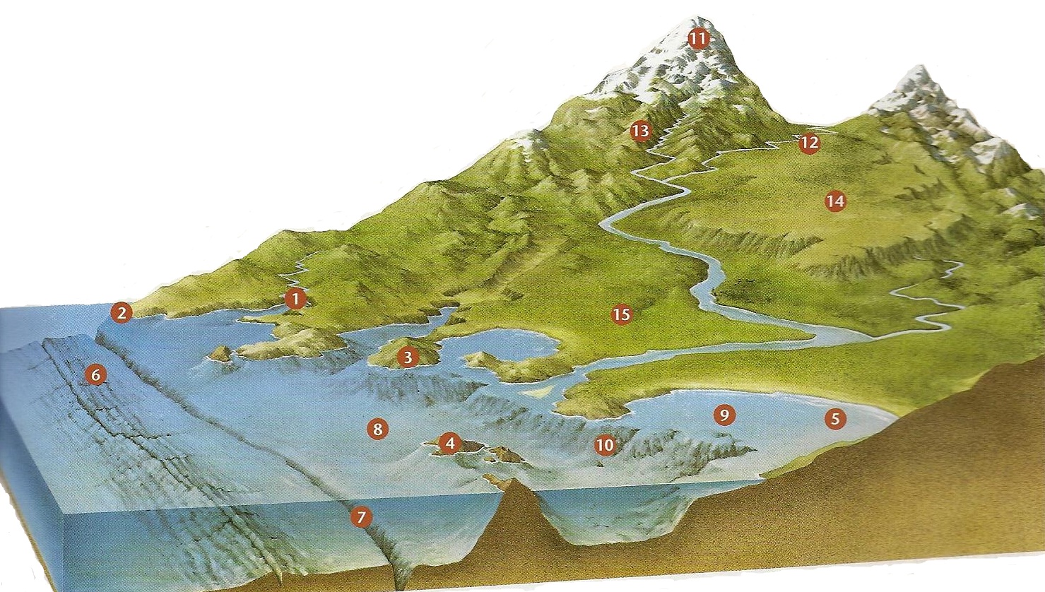
1. Ría 2. Cabo 3. Península 4. Isla 5. Golfo 6. Dorsal Oceánica 7. Fosa marina
8. Llanura abisal 9. Plataforma continental 10. Talud continental 11. Montaña
12. Depresión o cuenca 13. Valle 14. Meseta 15. Llanura
GEOLOGICAL HAZARDS
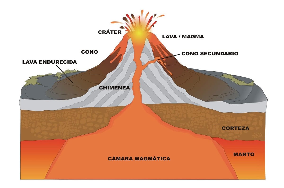
VOLCANOES
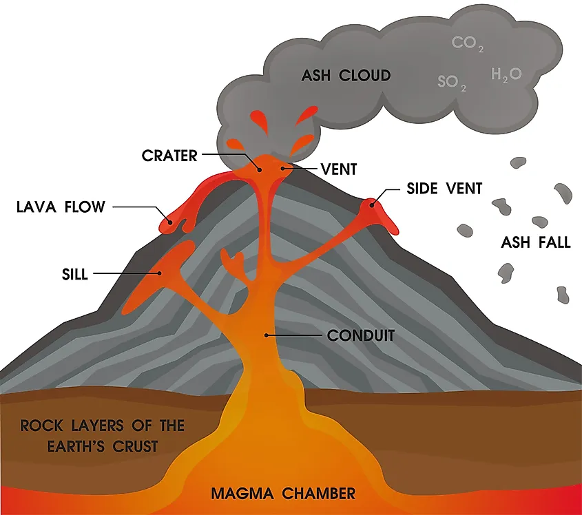
Pincha en la siguiente imagen para interactuar con las partes de un volcán

Evolución del volcán de la Palma: vídeo
Explicación del volcán de la Palma: vídeo
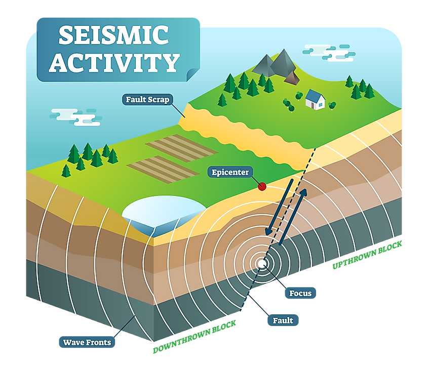
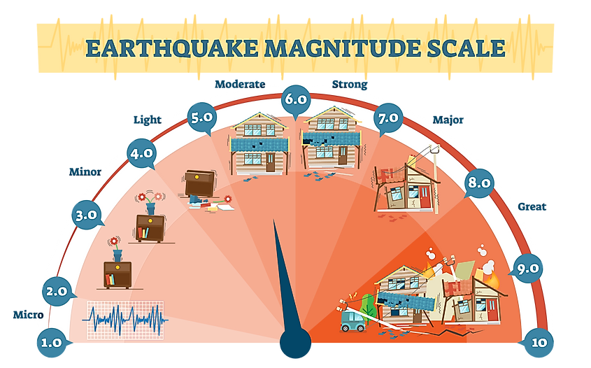
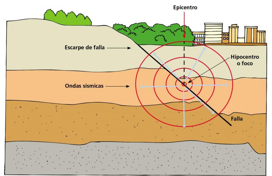
EARTHQUAKES
Types Of Seismic Activity

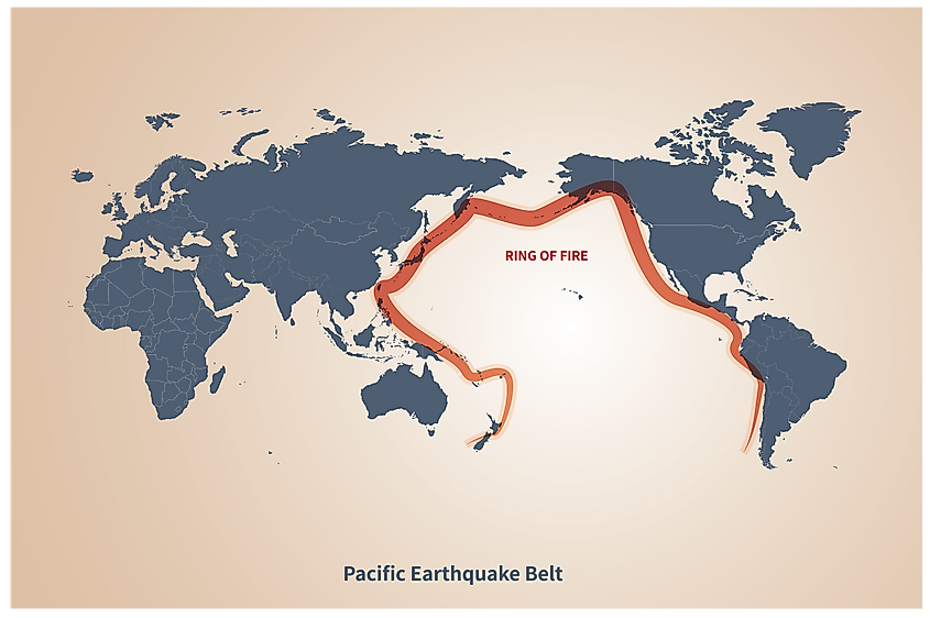
Earthquake-prone Regions Of The World
The Pacific Ring of Fire
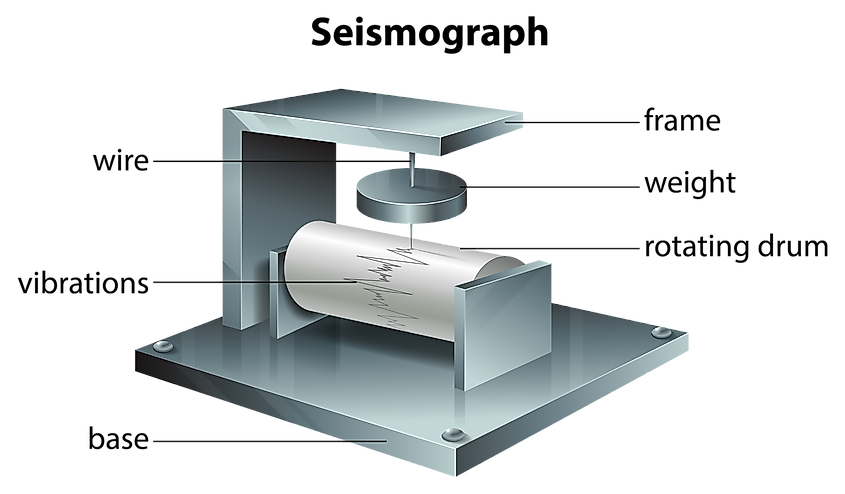
Measurement Of Earthquakes


0 Comentarios